Data collected in 2009 as part of the Computer Modeling of Heritage Resources, Peru.
cuzco_1978.zip (TIF, 16MB)
Collected 2009
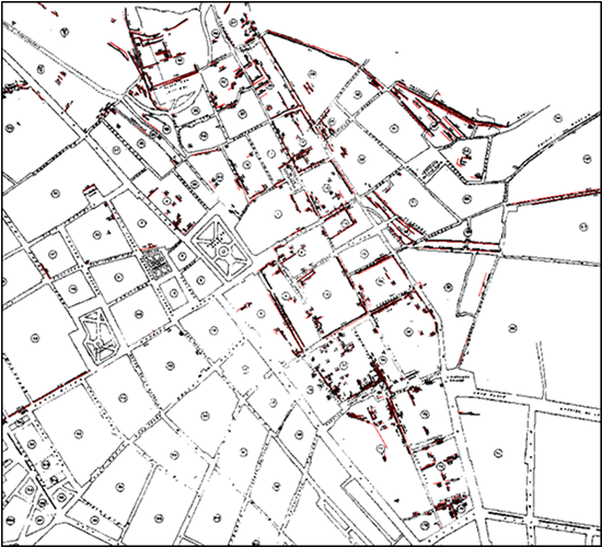
Georeferenced map from 1978 showing existing walls (slightly thicker black). Red features are walls verified by Geomatics students and mapped with attribute data on wall height.
Please note. This data is distributed under a Creative Commons 3.0 License (see http://creativecommons.org/licenses/by-nc/3.0/ for the full license). You are free to share and remix these data under the condition that you include attribution as provided here. You may not use the data or products in a commercial purpose without additional approvals. Please attach the following credit to all data and products developed there from:
Credit: Instituto Nacional de Cultura, Center for Advanced Spatial Technologies, (University of Arkansas) and Cotsen Institute for Archaeology (UCLA)
Longer version: Data developed under the authority of the Instituto Nacional de Cultura, Vladimir Dávila – Arquitecto del P.A.N Machu Picchu, Director del P.A.N Machu Picchu Direccion Regional de Cultura Cusco and Fernando Astete – National Archaeological Park of Machu Picchu. Data acquired, processed and distributed by the Center for Advanced Spatial Technologies staff (Snow Winters, Malcolm Williamson and Katie Simon) and by students in the 2009 Cotsen Institute for Archaeology (UCLA) Cuzco/Machu Picchu Field School, Alexei Vranich Director.