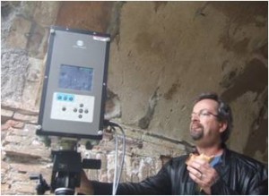
Using the Optech ILRIS-3D laser scanner and the Konica-Minolta VIVID 9i, data was collected in 2007 as part of the Ostia Antica 3D Scanning Project.
Several data sets from the Ostia Antica survey are available here as point clouds in the Polyworks PWK format (as IMInspect projects).
For the PWK formats we recommend using the free Polyworks | Viewer (previously the Polyworks IM Viewer), and for the obj files we recommend Rapidform Geomagic Verify Viewer (previously the Rapidform Explorer).
To open a PWZIP file – click on the .pwzip link below and save the file; if you are using Mozilla Firefox, right click on the link and save the file. Open IMView, left click on “File” at the top of the screen. Select “Open project”, then “Add Workspace” and browse to the .pwzip’s saved location. Next, choose a local location to extract the files. The files will unzip and the project will appear in IMView’s workspace file structure. Left click on the project and open.
Click on the blue placemarkers to access data-sets from Ostia Antica.
View Ostia Antica in a larger map
Please note. This data is distributed under a Creative Commons 3.0 License (see http://creativecommons.org/licenses/by-nc/3.0/ for the full license). You are free to share and remix these data under the condition that you include attribution as provided here. You may not use the data or products in a commercial purpose without additional approvals. Please attach the following credit to all data and products developed there from:
Credit: University of Arkansas Honors College, Center for Advanced Spatial Technologies,School of Architecture and Humanities Program in Fulbright College (University of Arkansas)
Longer version: Data developed under the authority of the Soprintendenza per i Beni Archaeologici di Ostia- Angelo Pellegrino, Direttore degli Scavi di Ostia Antica. Data acquired, processed and distributed by the Center for Advanced Spatial Technologies staff.
