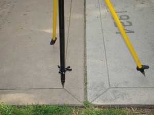
If external control is collected for the project, the table below describes the appropriate documentation for this process. Download a printable form in PDF format here or in a spreadsheet (.xlsx) format here.
For each control point:
| Entry | Description |
| Point ID | ID or name given to the point. |
| Source and datum (total station, GPS, etc. and WGS84, UTM, LRF) | Identify the source for control point collection and the datum used during data collection. |
| xyz coordinates | List the three-dimensional coordinates for each control point. |
| xyz covariance matrix or estimated error | Provide full correlation if available (from survey adjustment or GPS baseline solution), otherwise provide estimated standard deviation or variance of each coordinate. |
| Textual description of location | Provided a textual description for the location of each control point. |
| Image name with control point location indicated | Name of image with the control point location clearly indicated. |
| Geometric constraints on reference features or control | List any known geometric constraints for reference features or control. |
| Coordinate System | Name of coordinate system, datum and projection. |
