Airborne Scanning |
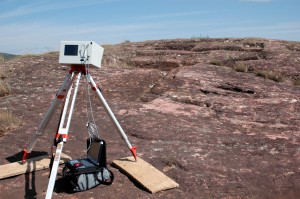
Mid-Range Terrestrial Scanning |
Close-Range Scanning

3D scanners allow for a large number of measurements to be collected across the surface of a structure, landscape or object, resulting in a dense three-dimensional digital data file that accurately portrays surface features.The data collected are an accurate mapping of the surface which cannot be obtained as easily or as accurately by traditional surveying or other recording techniques. The resulting 3D model provides investigators with the means to study and analyze the scanned site, structure, or object. It further provides a “digital copy” of the subject that can be revisited as the site or object changes over time. The benefits of this virtual means of measurement go beyond its very significant presentation value by contributing to design of better sampling strategies, enhancement of scholarly analysis, and potential improvement of interpretation.
The Center has an exceptional inventory of high performance scanners. There are
five 3D scanners. Three of these are mid to long range units - an Optech ILRIS, a Leica C10, and a Z+F 5006i - and two are short range - a Breuckmann smartSCAN HE and a Minolta Vivid 9i. CAST also provides access to a suite of
software for processing and visualization. In addition to extensive work with close- and mid- range scanning, CAST researchers are working with the
Arkansas NCRS on the
Bayou Meto lidar survey, a project using airborne laserscanning to map very low relief areas in Southern Arkansas.
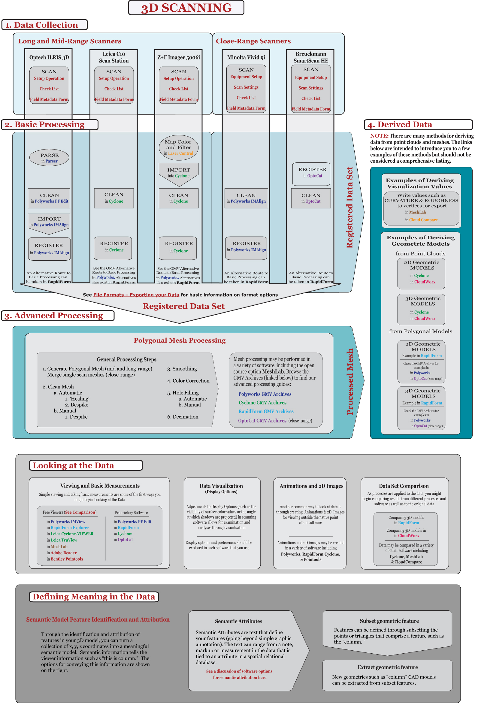
Click on the image below to activate the interactive guide. Links to specific examples and articles will become clickable upon zooming.

 3D scanners allow for a large number of measurements to be collected across the surface of a structure, landscape or object, resulting in a dense three-dimensional digital data file that accurately portrays surface features.The data collected are an accurate mapping of the surface which cannot be obtained as easily or as accurately by traditional surveying or other recording techniques. The resulting 3D model provides investigators with the means to study and analyze the scanned site, structure, or object. It further provides a “digital copy” of the subject that can be revisited as the site or object changes over time. The benefits of this virtual means of measurement go beyond its very significant presentation value by contributing to design of better sampling strategies, enhancement of scholarly analysis, and potential improvement of interpretation.
The Center has an exceptional inventory of high performance scanners. There are five 3D scanners. Three of these are mid to long range units - an Optech ILRIS, a Leica C10, and a Z+F 5006i - and two are short range - a Breuckmann smartSCAN HE and a Minolta Vivid 9i. CAST also provides access to a suite of software for processing and visualization. In addition to extensive work with close- and mid- range scanning, CAST researchers are working with the Arkansas NCRS on the Bayou Meto lidar survey, a project using airborne laserscanning to map very low relief areas in Southern Arkansas.


