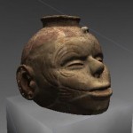
 Beyond Hollywood movies and video games, three-dimensional visualization and animation play a fundamental role in the academic community. Adding a visual component to any research project often provokes novel and interesting questions that might not have been previously regarded. For example, the visual reconstruction of a Native American house or a Roman insula leads to questions about structural elements, interior design, furnishing and decoration. In a modern setting, visualization of a series of different proposed buildings can provide city planners and the public with important information on whether to approve or deny permits and/or information useful to assess the outcome of alternative planning scenarios. Visualization of multiple data sets from a range of instruments such as aerial cameras, laser scanners and geophysical devices can lead to new insights that each alone could not provide. The use of the latest visualization technology bridges both research and public interpretation and information. Complex processes and alternative outcomes can be visualized and understood by a wider audience.
The field of scientific visualization is large and work at CAST generally focuses on visualization of moderate scale data and particularly on representations of buildings, objects and environmental settings of modest (e.g. city or county) scale. A key research and application direction is the integration of advanced mensuration techniques (e.g. photogrammetry and laser scanning) with visualization. We use multiple software packages for visualization and mensuration steps, descriptions of these activities can be found at Software page.
See Modeling Data Sets for examples of some of the projects of CAST.

