Checklist | Metadata Forms | Setup Operation
 The Intelligent Laser Ranging Imaging System (ILRIS-3D), manufactured by Optech, Inc., is an imaging system that offers direct-to-digital 3D models of any scene. The scanner is about the size of a motorized total station, with an on-board digital camera and a large-format LCD viewfinder. The ILRIS-3D has a visual interface similar to that of a digital camera. The unit is portable, weighing 12 kg and it can easily be used in the field by a single person. As the laser is Type 1, it can be safely used in all settings. With a 20% reflectance surface it has a range of 3m – 1
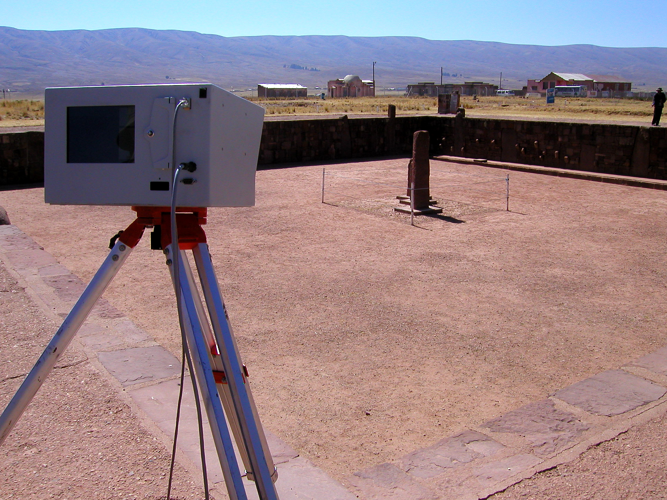
km. Accuracy in the X,Y and Z dimensions is +- 10 mm at 100 m. Point cloud data are captured at 2,000 points/second. A typical scene with adjacent point spacing can be fully scanned in 10-15 minutes, capturing 1.2 to 1.8 million points.
Detailed technical specifications for the instruments are available here. More details are provided at the Optech Web site.