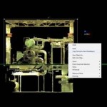
The term laser scanning is used to describe any technology which accurately and repeatedly measures distance (based on a precise measurement of time) and collects these measurements into a point cloud based on the measured coordinates. This point cloud of coordinates is used to produce information on the morphology of the object being scanned. Mid-Range Terrestrial laser scanners designed for mid-range measurement projects typically use either Time of Flight or Phased Shift technology. In Time of Flight (TOF) scanning individual short pulse of laser radiation is emitted from the scanner and the time it takes for the pulse to travel to the object being scanned and return to the instrument is measured. In Phase Shift scanners a continuous beam of laser radiation is emitted from the scanner and the distance is calculated by measuring the phase shift between the emitted and received laser beams.
Applications in Terrestrial Laser Scanning include architectural scanning and Building Information Modeling (BIM), scanning of geological profiles or scarps, site scale archaeological recording for conservation, and monitoring of infrastructure like bridges and overpasses.
Read about CAST’s mid-range scanners the C10 and Z+F.
Read about the software used at CAST for working with mid-range scan data: Leica Cyclone, Laser Control, and Polyworks.
Check out some of our projects.
