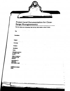
 A number of guides and documentation standards for the collection and processing of close-range photogrammetric data (or in some cases for photographic documentation in general) have been published by various organizations. This form and other metadata forms on this site follow the Archaeology Data Service (ADS) Guides to Good Practice. See the list of helpful webpages and publications for a link to the ADS guides and other helpful links.
Every CRP project should contain project level documentation, including a description of the project and site, date(s) of the survey, name(s) and organization(s) of the surveyor(s), and other useful notes. The table below describes the appropriate documentation for this process and you can download a printable form in PDF format here or in a spreadsheet (.xlsx) format here.
| Element | Description |
| Title | The project name or name for the dataset. |
| Description | The original purpose for the survey work. |
| Subject | Keywords for the subject content of the dataset (qualified using e.g. the English Heritage NMR Monument Type Thesaurus or the MDA Object Type Thesaurus). |
| Coverage | Site location and description. The address, or coordinates for the site and a description of the site and object or structure to be surveyed. Coverage should also include any relevant period terms. |
| Creators | Full name and organization(s) of the surveyor(s) |
| Identifiers | Project or reference numbers (e.g. HABS/HAER/HALS survey number) used to identify the dataset. |
| Dates | Date or dates that the survey was conducted in both the field and/or lab. |
| Intended accuracy or scale of the survey | The originally intended accuracy or scale that the survey was to achieve. |
| Make & model of camera(s) and lens(es) | Detailed make and model of the camera and lens used for the survey. List the associated calibration files if applicable. |
| Description of reference information used | Describe any existing reference information available to the surveyor(s), including paper plans or digital spatial data of the site or object. |
| Additional project notes | Any additional project notes that the surveyor feels applicable. |