[wptabs mode=”vertical”] [wptabtitle] Initial Automatic Classification[/wptabtitle] [wptabcontent]In most ALS projects, in the first instance, the data is automatically classified. No automatic classification is perfect, and therefore visual assessment and the manual re-classification of some returns are important steps in the creation of a high quality hydro-enforced terrain model, and the development of other derivatives of ALS point clouds. The Bayou Meto terrain model developed at CAST was processed using TIFFS, a software program which implements a morphological filter. Other good low cost or open source software for automatic classification includes LASTools and MCC-Lidar.
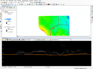
Automatically classified Point Cloud seen in profile. Terrain points (class 2) are orange, and off-terrain points are grey.
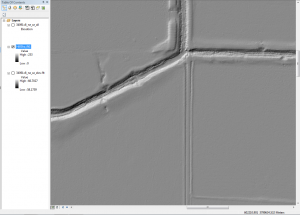
[wptabtitle] Create DTMs and Hillshades[/wptabtitle] [wptabcontent]To facilitate visually identifying incorrectly classified returns, it’s useful to interpolate the automatically classified ground points into a DTM, and to create basic hillshades. Many classification errors will be readily apparent in the hillshaded models. The DTMs for the Bayou Meto project were created using LP360 for ArcGIS.
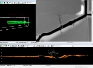
[/wptabcontent][wptabtitle] Linked Viewers[/wptabtitle] [wptabcontent]Viewing the point cloud simultaneously with the hillshaded terrain model, you can navigate quickly to ‘problem areas’ to re-classify any incorrect points in the ALS point cloud.
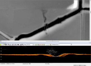
[/wptabcontent][wptabtitle] Drawing Profiles[/wptabtitle] [wptabcontent]Draw a profile across an area of the terrain model where potential mis-classifications have been identified. Depending on how regular the terrain surface is, set the depth of the profile. Areas where the elevation of the terrain varies greatlygenerally require narrower profiles to clearly visualize the separation between the ground surface and low vegetation.
[/wptabcontent][wptabtitle] Editing classifications[/wptabtitle] [wptabcontent]When editing the classification of the points it’s best to set the point cloud coloring style to ‘by class’ rather than by elevation or by return, as it’s then easier to see which points should be re-classified. In LP360 you can change the classification of points by selecting them in the profile view using a ‘brush’ or ‘lasso’ tool and then typing the number of the class they should be and hitting enter. [/wptabcontent]
[wptabtitle] Typical problem areas[/wptabtitle] [wptabcontent]Work across the dataset systematically, until all problem areas have been improved. Note that areas with dense, low vegetation, large numbers of small buildings, and mixed steep slopes and vegetation are the most likely to contain mis-classified returns, and will require more effort. In the Bayou Meto dataset, the edges of streams proved typical problem areas, combining sloping terrain and low, dense vegetation.
[/wptabcontent][wptabtitle] Re-creating the terrain models[/wptabtitle] [wptabcontent]After re-classifying the ALS returns, it is necessary to re-create the terrain models and any other derivatives. These new models are the basis for further processing and analysis.
[/wptabcontent] [/wptabs]
