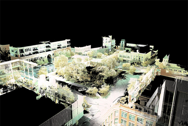
Through support from the National Science Foundation as part of CI-TRAIN Project, CAST is hosting a series of summer field classes.
Recording, Visualizing, and Analyzing the Urban Setting – 2012 Field School
The CI-Train Project continues to make it possible to offer this class again in the summer of 2012. This six-week class includes students studying design, geography and environmental dynamics. This year’s project examines how planned communities are conceived and how they take shape, using a local neighborhood in northwest Arkansas as the site for the semester. Teams and individuals will again work with remotely gathered data and they will collect data in the field. Students will be exposed to technologies and methods to visualize and analyze a community-scaled site. Tools used will include ArcGIS, photogrammetry, the Leica C10 laser scanner and Cyclone software.
Recording, Visualizing, and Analyzing the Urban Setting – 2011 Field School
The data is in .xyz ascii and .pts file formats. To explore theSE data sets, we recommend using Polyworks IMView or Leica Cyclone-VIEWER. To access views from the scanner positions through a web browser, use Lecia TruView and Internet Explorer. For access and instructions on using TruView, please see: Fayetteville Square Site Map and Bentonville Square Site Map.

In 2011, the summer course continued to utilize equipment and funding provided through the CI-Train Project, hosting students from architecture, landscape architecture, computer science and engineering, and geography departments. This program introduced University of Arkansas students to the latest methods, hardware and software to record and analyze urban settings. Studying the Fayetteville and Bentonville town squares, teams used remote data and collected on-site data that included stereo imagery, Google Street View, GPS data, laser scanning data and traditional methods of observation/research. Students used the Leica C10 laser scanner to scan the Fayetteville and Bentonville town squares to produce the data sets available here. Final projects used the data to create comparisons, analysis, and visualization in various modeling programs as well as ArcGIS.
3D Recording and Visualization Training – 2010 Field School
A 2010 University of Arkansas summer course used equipment and funding provided through the CI-Train Project and focused on 3D Recording and Visualization for high school and college students. Students were given hands-on instruction in these methods and had the opportunity to gain practical experience by applying them to modern buildings and structures on the University of Arkansas campus.
Scans were collected in the business plaza of the UArk Campus with the Leica C10 laser scanner and the Z+F Imager 5006i laser scanner. This area included the J.B. Hunt Transport Services Inc. Center for Academic Excellence, Sam M. Walton College of Business, Willard J. Walker Hall, Kimpel Hall and Donald W. Reynolds Center For Enterprise Development buildings. In addition to the scanning data available here, students also collected GPS data and practiced modeling and visualizing the various data.
Credit: Center for Advanced Spatial Technologies and Facilities Management, Operations and Maintenance and Campus Planning Divisions, (University of Arkansas)
Longer version: Data acquired with support from NSF funded CI-TRAIN project. Data processed and distributed by the Center for Advanced Spatial Technologies.