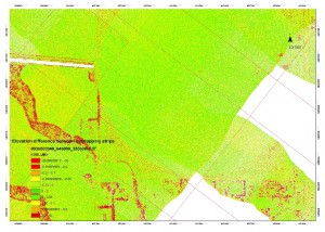
[wptabs mode=”vertical”] [wptabtitle] ALS data[/wptabtitle] [wptabcontent]ALS data is often collected in strips, with each strip representing an individual flightline. Typical ALS surveys have at least 20% overlap between adjacent flightlines and a few cross-strips where data is collected at an orientation perpendicular to that used for the main survey, improving accuracy.
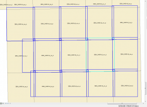
[/wptabcontent][wptabtitle] Tile Schemes[/wptabtitle] [wptabcontent]Because ALS datasets are usually very large, they are often divided into regularly sized tiles. These tiling schemes can help with the speed of data loading, and allow users to load areas of the dataset selectively for processing or analysis.
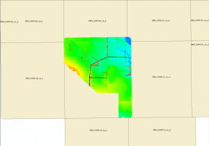
Tiles represent .las file locations, one file is loaded. Note that the tiles are regular rectangles, and don't always exactly match the extents of the .las file.
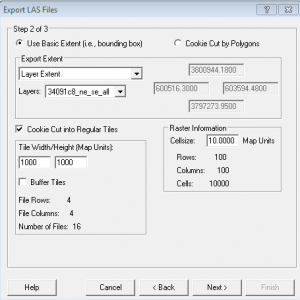
[wptabtitle] LP360 tiling tools[/wptabtitle] [wptabcontent]LP360, like most ALS software, provides tools to perform the tiling task. Typical tile sizes include 0.5×0.5km or 1x1km tiles. The naming convention for the tiles should follow a sensible progression, for example reflecting official map grid designations for the area, or following an east to west progressive sequence across the survey area.
[/wptabcontent]
[wptabtitle] Creating Footprints[/wptabtitle] [wptabcontent]A vector file containing the footprints for each tile, designating the area covered and linking to the .las file or derived terrain models, are a common way of efficiently representing the ALS dataset in a GIS environment. Using LP360, individual files or groups of files can be loaded by selecting their footprints.
[/wptabcontent][wptabtitle] Metadata[/wptabtitle] [wptabcontent]Metadata for ALS is typically generated for the entire survey, rather than per tile. This project level metadata is usually stored in a long form report. That said, some metadata will be stored in the .las header for each tile. Attributes including the total number of points in the file, whether or not it has been classified, and the software used to process the data are typical items found in the header. Further, non-standard, metadata can be stored as a series of attributes in the vector footprint for each .las tile.
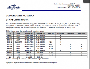
Project level metadata provided by the vendor, Aeroquest, provides important information about the survey.
[wptabtitle] laz compression[/wptabtitle] [wptabcontent]The ASPRS standard .las format is commonly used for storing ALS data. The compressed .laz format is also useful, particularly for the datasets which are being archived. Data can be converted from .las to .laz (and back) using LASzip.
[/wptabcontent]
[/wptabs]
