Untitled Document
Find GMV content using tags!
Archaeology/Historic Recordation
,
Data Collection
,
Data Viewing
,
Leica
,
mid-range scanning
,
Modeling
,
Photogrammetry
,
Sample Data
,
Workflow
Search for:
Geospatial Modeling & Visualization
A Method Store for Advanced Survey and Modeling Technologies
Skip to content
GMV
About the GMV
Using the GMV
PDF Repository
CAST Projects & Collaborations
Geophysics
Geophysics Overview
Hardware
EM38-MK2
Grad601-2 Magnetic Gradiometer
SIR-3000 Ground Penetrating Radar
STING R1 Earth Resistivity Meter
Software
ArchaeoFusion
ArcheoSurveyor
RADAN
Surfer
Geophysics Data and Projects
GPS
GPS Overview
Hardware
Trimble Juno
Trimble GeoExplorer
Trimble 5800
Trimble 5700
Trimble 5600
Leica CS15 Controller
Leica GS15 Receiver
Software
Opus
Pathfinder Office
Geomatics Office
Geo Office
GPS Data and Projects
Modeling
Modeling Overview
Modeling Software
AutoCAD/Revit
Leica Software
RapidForm
SketchUp
Unity
Vue
Modeling Data and Projects
Digital Photogrammetry
Digital Photogrammetry Overview
Hardware
Canon 5D Mark II
Nikon D200 IR
Nikon D200
Nikon D70
Epson 10000XL
Software
Agisoft Photoscan
Eos Systems PhotoModeler
ERDAS Imagine LPS
Photogrammetry Data and Projects
University of Arkansas, Fayetteville
Tiwanaku, Bolivia
Saqsaywaman, Peru
Knowth, Ireland
Gabii Project Photogrammetry
3D Scanning
Scanning Overview
Airborne Laser Scanning
Mid-Range Terrestrial Laser Scanning
Close-Range Scanning
Hardware
Breuckmann HE
Konica-Minota Vivid 9i
Leica C10 Scan Station
Z+F 5006i
Optech ILRIS 3D
Microsoft Kinect
Software
LASTools
Leica Software
Leica Cyclone
Leica CloudWorx
Leica Truview
Laser Control
OPTOCAT
Polyworks
QCoherent LP360
RapidForm
Scanning Data and Projects
Ostia Antica, Italy
Machu Picchu, Peru
Univeristy of Arkansas, Vol Walker Hall
University of Arkansas, FAMA Plant Data
University of Arkansas, CI-Train Field Schools
Virtual Hampson Museum
Equipment
Equipment Overview
Equipment Checkout
Equipment Calendar
Equipment Use Cost
Field Equipment Use Policy
Data and Projects by Region
Data by Region Overview
Italy Data
Peru Data
United States Data
Bolivia Data
Egypt Data
←
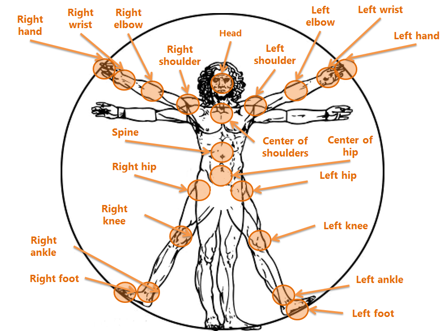
Microsoft Kinect – An Overview of Working With Data
Kinect-Sensors-on-Human-Body
Depth Image RGB Image
Skeletal Tracking OpenNI
Bookmark the
permalink
.